 |
|
Departing Seattle |
|
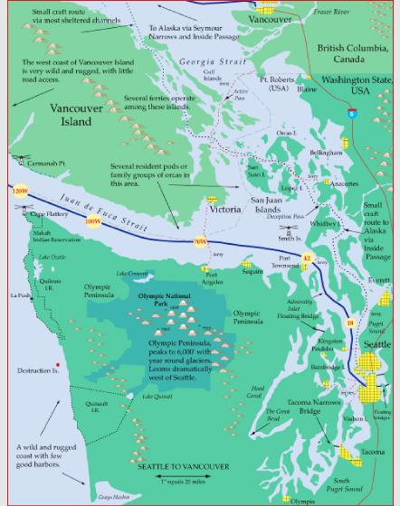
Seattle Departures Your ship travels around 20 mph.. For the first two hours, you'll be traveling up Puget Sound, an inland sea. Look for ferries - you cross three routes - that take commuters from the busy east side of the sound to bedroom commuities on the sleepier west side. About two hours after leaving Seattle, you'll pass a lighthouse on the left - Point Wilson, and enter the much wider waters of the Strait of Juan de Fuca. To the north are the San Juan Islands, a major boating destination with many second homes. If you are lucky, your ship will turn north here, pass west of the San Juans, then west of Vancouver and up toward Seymour Narrows and the traditional Inside Passage route north to Alaska. However, most Seattle to Alaska cruises, travel out Juan de Fuca Strait and up the outside coast of Vancouver Island. As the evening progresses you'll be passing the wilder and wilder country of the Olympic Peninsula. About Mile 120W, you'll be at an area that before electronic navigation used to be called the Graveyard of the Pacific. Unpredictable currents and frequent and thick fog made it a very challenging place. Plus the shores on both sides were very unforgiving: steep bluffs and rocky beaches. So many ships came to grief on the southwest shore of Vancouver Island that a trail was created with cabins at intervals stocked with firewood and food and with a telephone to the nearest lighthouse. Today ships have radar and GPS to guide them through the fog and the trail has become the West Coast Trail, a very challenging 76 km hike that usually takes a week. |
||||||||
 |
||||||||
Cruise ships usually leave Seattle around 5, pass Point Wilson around 7, Victoria around 8:30, and Cape Flattery around 11 pm. |
||||||||
Along The Way: |
||||||||
 |
||||
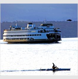
Commuter ferries are a big part of Puget Sound life - each day tens of thousands of workers cross from the westside bedroom communities like Kingston and Bainbridge Island to the busy Seattle- Everett corridor. If your work on the east side is close enough for you to walk to or bus to after you get off the ferry, life is good. Drive to the ferry, park, walk on, sit with your buddies in your usual spot, get a latte, catch up on work or the internet (WiFi on board) and after a pleasant half hour ride, get off and walk to work.. But.. if you have to drive on, it's all a bit trickier.. Say you want to get onto the Bainbridge Island to Seattle 7:55 a.m.- a prime morning commuter boat - well, you'd better be in line by 7:15 or so on busy days as even with a 220 car capacity, it fills up! |
||||
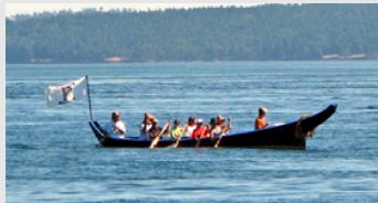
Native culture is strong all along the Northwest coast. Tribal casinos have brought major infusions of cash to those tribes with reservations near urban areas. So many of the old traditions like totem and mask carving are enjoying a renaissance. Recently coastal tribes have begun to make replicas of the giant old cedar canoes that used to be such a feature of native culture. The new ones are often made out of fiberglass and each summer there are tribal festivals where canoes with tribal paddlers from all throughout the Northwest meet to celebrate their culture. |
||||
 |
||||
Marrowstone Lighthouse, Mile 35. At the north end of Fort Flagler Park. Fort was one of three that straddled the entrance to Puget Sound, and whose cannons created a deadly triangle of fire to deter enemy ships from entering. |
||||
 |
||||
 |
||||
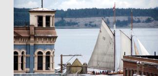
Port Townsend is the town on the west side of your ship at about Mile 38, a community with a heavy arts and crafts flavor. Many of the towns buildings were constructed in the early 1900s and still retain their Victorian charm. The town is also the Puget Sound center for wooden boat enthusiasts. The houses on the bluff above town have spectacular views of the busy entrance to Puget Sound. |
||||
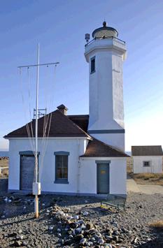
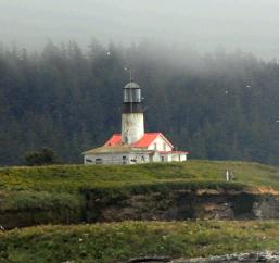
Passenger Tip Point Wilson is a major lighthouse to the west at Mile 42, and marks the transition from the inside, sheltered waters of Puget Sound to the much more open and wilder waters of Juan de Fuca Strait.This will be about 2 1/2 hour after you leave Seattle and is a major landmark. From here to the west the landscape just gets rougher and wilder, with the Olympic Peninsula to the south and Vancouver Island to the North. Finally when you get to the entrance marked by Tatoosh Island Lighthouse, (your ship will probably pass about 3 miles north of the island) the most Northwesterly point in the lower 48 states, you'll be entering the North Pacific Ocean. |
||||||||||
 |
||||||||||
 |
||||||||||
Tatoosh Island |
||||||||||
Point Wilson |
||||||||||