 |
|
Small Craft Route - Desolation Sound - NE. of Mile 200 |
|
If there were ever a misnamed place, it is this. Basically a big wilderness marine park, it was named by British explorer Captain George Vancouver on a particularly rainy June in 1792. George also had a bit of a melancholy disposition to start with.. In reality it is a spectacular part of the BC coast - far enough north to be off the beaten path, but not yet in the cooler, wetter, part of the coast which starts just a few miles north. Plus the water is warm enough to swim!! Turns out that the tides sort of divide here - part ebbs north to Johnstone Strait and part ebbs south to Georgia Strait, but the bottom line is that the tide goes up and down, but the water pretty much stays there and gets warmer and warmer! Not only that but nice tasty oysters grow wild on the rocks in many of the anchorages. And summer it can get hot! I was up here with friends the last week of June one year in a chartered trawler style power boat and it was so warm that we would go up to the shade of the canopy on the flying bridge to have our cocktails and only go into the cabin to cook after the sun had gone over the mountain and it had cooled off. The long and often windy trek up Georgia Strait to get here sort of thins out the crowd of boaters, but to many mariners, especially those from the Puget Sound area, Desolation Sound is sort of the Shangri-La - the destination of many a long summer cruise! Next: Yuculta Rapids and the Discovery Islands |
 |
||||||
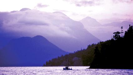
Looking north toward Sara Pt. and the mountains of Desolation Sound - the ruggedness of the country here dashed the hopes of Vancouver Island residents who had hoped that a railroad could cross from the mainland over to the island with a crossing of Seymour Narrows. The bridge across Seymour would have had a support pillar built on top of the infamous Ripple Rock. |
|||||||
 |
|||||||
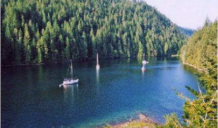
Sailboats at Roscoe Bay. Here the entrance is so shallow that you need to enter at high tide. At low tide it dries, making the protected cove totally landlocked! |
|||||||
 |
|||||||
 |
|||||||
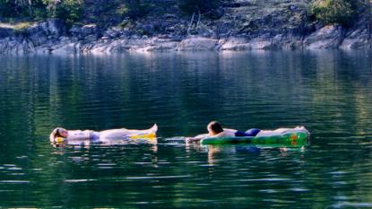
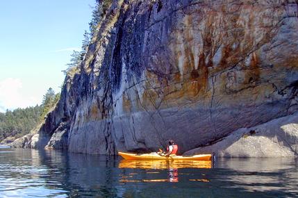
In Black Lake, a short hike from Roscoe Bay. Right: Desolation Sound is very popular with Kayakers |
|||||||