 |
|
 |
||||||||
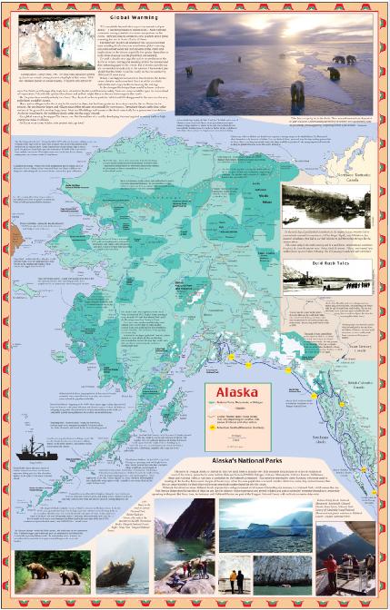
Included in The Alaska Cruise Handbook Map is 22x34 inches, with lattitude/longitude grid so that you can find your position either from information available on the ship, your own GPS, or the map function - if you have it - on your cell phone. The dark lines on the map are the major cruise ship routes. The yellow circles are Milemarker numbers - miles from Seattle. This numbering system allows ships to announce their position as "We are at Mile 742 on your Alaska Cruise Handbook map." This a lot more user friendly than, "We are passing Point Baker in Sumner Strait." The map is full of the rich stories that the region is full of. This side of the map shows detail of the cruise route all cruise ships take back and forth to Alaska as well as the route from Southeast Alaska up the Gulf of Alaska to College Fjord, Hubbard Glacier, Seward and Whittier |
||||||||